


Space radar monitoring of oil spills in the waters
Space radar surveys of waters can be performed every day regardless of cloud cover and light. The results of the survey are available for costumers through a secure web-GIS interface and via ftp-protocol within 1-2 days after the survey is complete (or within 1-2 hours after the survey if the area is covered by the receiving station).
According to the results of each survey, a vector layer of oil spills is generated and each oil spill gains its own attributes. Original pictures are delivered to customers through the ftp-protocol. Processing results ("Quick-bows" pictures and the vector layer of oil spills) are delivered through a secure web interface.
Main features:са:
- oil spills on water surface are identified around the clock, regardless of weather conditions;
- oil spills of various size and age are detected;
- oil films with linear dimensions of 50-100 m and more can be detected;
- data about the detected oil spills can be delivered to customer through a secure web interface around the clock, 7 days a week, 365 days a year;
- maximum possible temporal frequency of satellite images of the same area is up to two times per day.
The content of the report about each identified oil spill::
- coordinates;
- date and time of detection;
- spatial orientation;
- size of oil spill;
- form of oil spill;
- wind speed in the area of oil spill, defined according to meteorological satellite and radar image itself;
- data about the unrest of the sea surface in the area of oil spill, defined according to meteorological satellite and radar image itself;
- the rate of flow in the area of oil spill;
- surface water temperature in the area of oil spill;
- the information about a ship which might be the source oil spill (In case the customer can provide data concerning the automated identification of ships);
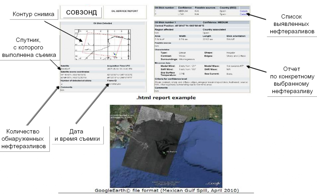 | |
| Пример веб-интерфейса поставки сервиса мониторинга нефтеразливов.
Внизу — quick-look снимка на картографической подложке с отображением выявленных на этом снимке нефтеразливов. Слева — список снимков, выполненных в рамках сервиса. При выборе конкретного снимка отображаются данные об этом снимке и список обнаруженных нефтеразливов. При выборе конкретного нефтеразлива – отображается отчет по этому нефтеразливу. | |
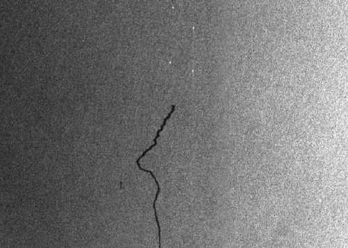 | |
| Пример отображения на радарном снимке нефтеразлива на поверхности воды | |