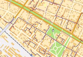
Desktop GIS

GIS with an expanded set of tools for working with spatial information using personal computer.

One of the most significant events in the field of remote sensing and GIS technologies, which will be held
13-15 April 2016 in the Imperial Hotel.
 GIS technology is a powerful tool for working and visual presentation of information. Using advanced features of database management systems (DBMS), being unique editors of raster and vector graphics and featuring the largest instrumentation for analytical operations, GIS are proved to be an effective means of solving problems in the field of cartography, geology, municipal management, land management, environment, transport, industry, agriculture and forestry.
According to some estimates, about 80% of all information associated with human activities has a spatial reference. For example, the work of housing and communal services requires information about the location of the service buildings, the passage of heating mains, power lines, etc., which can be represented in the form of a map. Supporting documentation (passports of objects, photographs, protocols), although it’s not displayed directly on the map, has a relationship with the map objects, which have a spatial reference. Therefore, GIS technologies are increasingly used in the modern information society, making it a convenient tool for solving several practical, scientific and educational tasks.